Overview
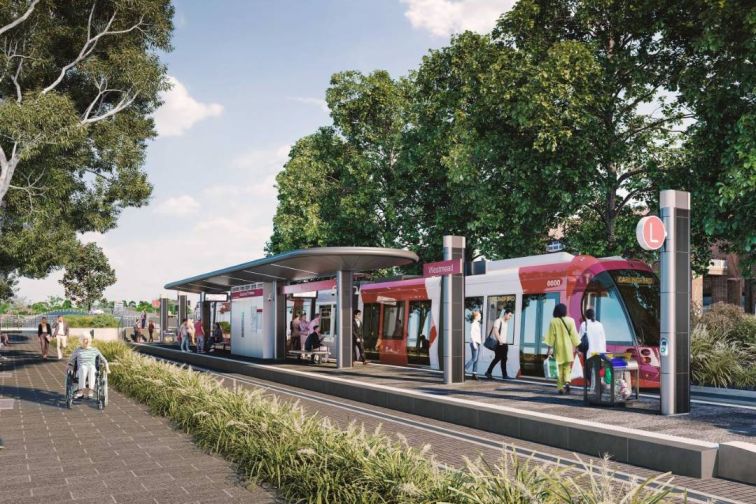
Stage 1 of the Parramatta Light Rail connects Westmead to Carlingford via the Parramatta CBD and Camellia with a 12-kilometre two-way track and 16 light rail stops.
It connects the Parramatta CBD to:
- Westmead Health Precinct
- CommBank Stadium
- Powerhouse Parramatta, the largest museum in NSW
- Parramatta Square and PHIVE
- Rosehill Gardens Racecourse
- three Western Sydney University campuses at Westmead, Parramatta and Rydalmere.
It also traverses the:
- Cumberland Precinct
- Camellia Town Centre
- private and social housing redevelopment at Telopea.
By 2026, around 22,000 people are expected to use the Parramatta Light Rail every day, with an estimated 130,000 people living within walking distance of the 16 light rail stops.
Current status
Parramatta Light Rail Stage 1 is now open to the public. Plan your trip by visiting https://transportnsw.info/

Parramatta Light Rail Stage 1
What's new
- High-frequency light rail services seven days a week.
- Modern and comfortable air-conditioned vehicles that are driver-operated and Opal card network integrated.
- The Parramatta Light Rail has replaced the train line between Camellia and Carlingford, offering more frequent services and better connections to town centres, including Parramatta and Sydney CBD.
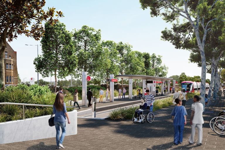
- A new 5.7km Active Transport Link between Carlingford and Parramatta to promote walking and cycling, built alongside the light rail alignment.
- The first green track delivered for a light rail project in NSW, totalling 1.3kms. Green track reduces urban heat among other benefits.
Stage 1 route

A static map that displays Stage 1 of the Parramatta Light Rail route. The route starts on the left-hand side of the map at the Westmead light rail stop, just above Westmead railway station. It heads north-east up Hawkesbury Road where it stops at Westmead Hospital and then Children's Hospital. From there it proceeds further east to the Ngara stop on Factory Street, then goes south down Church Street to the Benaud Oval, Fennell Street, Prince Alfred Square and Church Street stops. The route then heads east down Macquarie Street to the Parramatta Square and Robin Thomas stops. Then it continues down George Street, then to the Tramway Avenue stop, and then turns north-east stopping at Rosehill Gardens, Yallamundi, Dundas, and Telopea, with the last stop at Carlingford.
Frequently asked questions
What are the key features of this project?
There are:
- 16 highly accessible stops
- high-frequency light rail services seven days a week.
- integrated NSW Opal card ticketing
- modern and comfortable air-conditioned vehicles that can carry up to 400 passengers.
What attractions are nearby?
Parramatta Light Rail Stage 1 connects customers to major attractions, including the vibrant Parramatta Square, cafes and restaurants on Church Street, CommBank Stadium, Riverside Theatres, Powerhouse Parramatta and Rosehill Gardens Racecourse.
How much did the project cost?
The Parramatta Light Rail was part of a $2.875 billion program. This budget included:
- two major contracts to build and operate the light rail
- remediation works of the future light rail depot site
- road and traffic works and upgrades
- new bridges
- walking and bike riding paths
- urban design
- changes to the bus network
- project costs since 2015.
What type of vehicles are used on the Parramatta Light Rail?
Parramatta Light Rail Stage 1 use 13 Urbos 100 vehicles developed by CAF, which have been upgraded to incorporate an evolved design based on the fleet performance around the world.
These vehicles will provide a modern, fully accessible and comfortable customer experience, with real-time travel information.
How did Transport for NSW support businesses?
Transport for NSW recognised the importance of supporting and managing impacts on businesses before and during construction.
Dedicated Place Managers engaged directly with local businesses along the route to provide information and assistance, and to answer questions about the impacts of construction, such as wayfinding, noise and vibration, and access for deliveries and customers.
This included responding to preferred work hours and altering construction schedules, where possible, to provide a break in construction during busy meal periods for eateries.
See the Supporting businesses page for more information.
Did the project impact the heritage of the Parramatta region?
The Parramatta Light Rail had been designed to minimise impacts on heritage landmarks and items across the Parramatta region, such as using existing road and rail corridors to limit impacts.
While there have been some impacts on Aboriginal archaeological sites and non-Aboriginal heritage items, the project preserved archaeological, environmental, and Aboriginal heritage across the light rail route during its delivery.
The project ensured heritage was preserved and maintained by working closely with:
- NSW Government departments and agencies, including Heritage NSW and City of Parramatta Council
- Local community organisations, including the Local Aboriginal Land Council and Registered Aboriginal Parties
Visit Protecting heritage to find out more.
Are there plans to extend the light rail to Epping?
The connection from Carlingford to Epping is not part of the current Parramatta Light Rail program.
What is Parramatta Light Rail Stage 2?
Parramatta Light Rail Stage 2 will connect Stage 1 and the Parramatta CBD to Camellia, Ermington, Melrose Park, Wentworth Point and Sydney Olympic Park.
It will provide links to existing transport infrastructure, including heavy rail, bus and ferry services, as well as the future Sydney Metro West.
Parramatta Light Rail Stage 2 will have 14 fully accessible stops over 10 kilometres of new light rail track. Visit the Stage 2 page for more information.
Image gallery
See more artist's impressions, videos and maps in our gallery.
