Restricted waters
Where
When
Restricted area
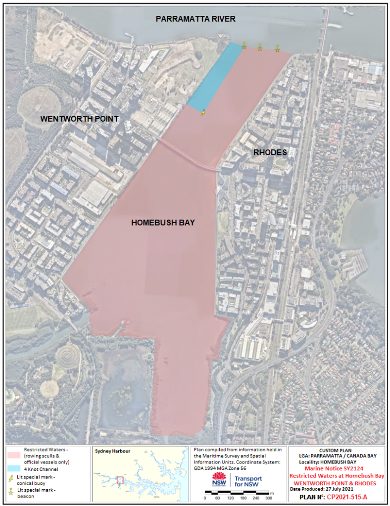
Vessel operators are advised that the majority of the waters in Homebush Bay, bounded by Rhodes, the Parramatta River and Wentworth Point have been declared as closed to navigation by all vessels (except rowing sculls, associated coaches and official vessels) commencing Monday 26 July 2021 and continuting indefinitely.
Navigation restriction
Access to Homebush Bay, (apart from the narrow 4 knot channel adjacent to the western shoreline from Wentworth Point south to Burroway Road), is closed to all vessels with the exception of rowing sculls, associated coaches and official vessels. The closure commences on Monday 26 July 2021 and continues indefinitely. The restricted area will be marked by three lit yellow Special Marks. See attached map.
Directions
Transport for NSW advises:
- Persons within the vicinity of the Restricted Waters must comply with any directions given by a Boating Safety Officer or Police Officer in relation to the Restricted Waters or to marine safety. Failure to comply with any such direction is an offence (Marine Safety Act 1998, s.15A - Maximum Penalty $3,300.00).
- Vessels are required to maintain a maximum 4 knot speed within the narrow channel and operators are reminded that the production of wash which impacts unreasonably on any bank or shore is an offence (Marine Safety Regulation 2016 – clause 11(2)) - Maximum Penalty $5,500.00).
Maps and charts affected
To see the area affected, refer to:
- Transport for NSW Boating Map – 9G (PDF 3.54MB).
Contact Transport for NSW information line
For further information concerning this navigation advice, please contact the Transport for NSW information line on:
Phone: 13 12 36
Monday - Friday
8:30am - 5:30pm
Saturday - Sunday
8:30am - 4:30pm