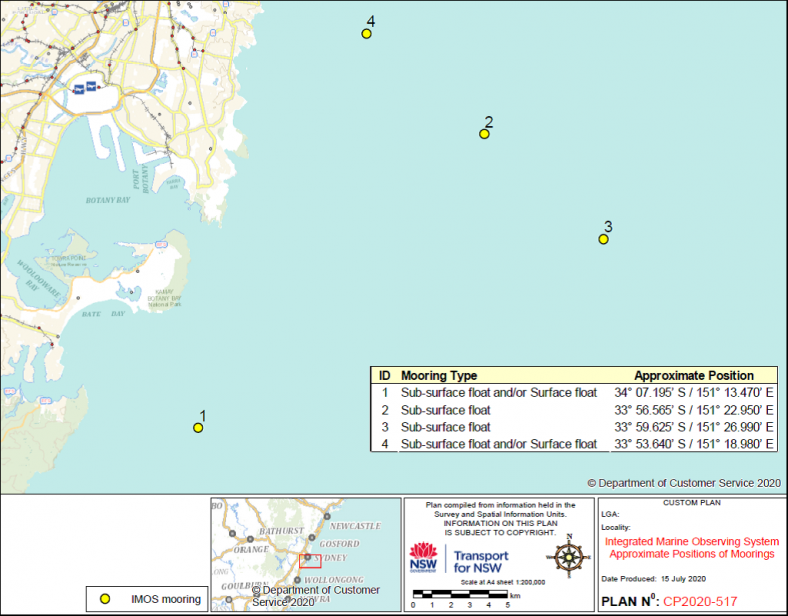
Surface and sub-surface moorings
Where
Sydney to Bundeena Coastal Waters, Tasman Sea
When
Thursday, 12 August 2021 until further notice
Navigation warning
A number of data acquisition moorings have been deployed by Integrated Marine Observing System (IMOS).
Vessel operators are reminded of the existence of sub-surface and surface moorings and to exercise caution when navigating in their vicinity. Unauthorised vessels are not to interfere with or secure vessels to the moorings.
| Mooring Type | Approximate Position |
|---|---|
| Sub-surface float and/or Surface float | 34° 07.195’ S / 151° 13.470’ E |
| Sub-surface float | 33° 56.565’ S / 151° 22.950’ E |
| Sub-surface float | 33° 59.625’ S / 151° 26.990’ E |
| Sub-surface float and/or Surface float | 33° 53.640’ S / 151° 18.980’ E |
Mooring types and approximate positions.
Directions
Transport for NSW advises:
- Persons within the vicinity of these waterways must comply with any directions given by a Boating Safety Officer or Police Officer in relation to marine safety. Failure to comply with any such direction is an offence (Marine Safety Act 1998, s.15A - Maximum Penalty $3,300.00).
Maps and charts affected
To see the area affected, refer to:
- Transport for NSW Coastal Boating Maps – 9 (PDF 1.29MB) and 10 (PDF 889.04KB).

Contact Transport for NSW information line
For further information concerning this navigation advice, please contact the Transport for NSW information line on:
Phone: 13 12 36
Monday - Friday
8:30am - 5:30pm
Saturday - Sunday
8:30am - 4:30pm