Recovery map

Find your nearest recovery centre or evacuation centre using the recovery map. You can also check for local information on affected roads, wellbeing support, temporary housing, clean-up help and more.

Disaster recovery map

Information about recovery centres, closed roads, temporary accommodation, wellbeing support and clean-up help.

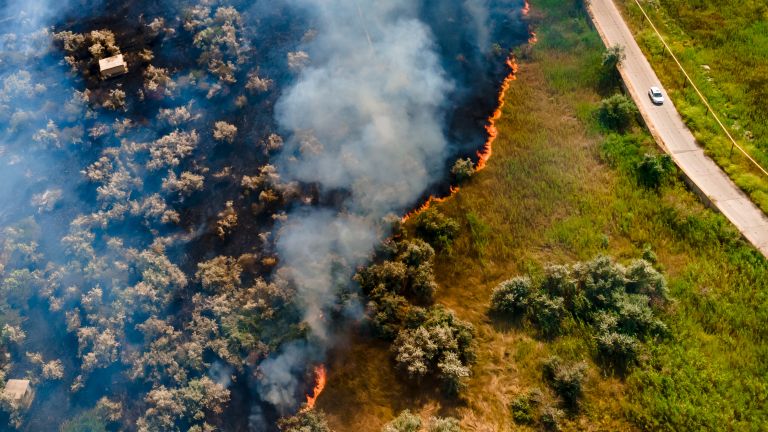
Bushfire near road

Emergency support

  • If your life is in danger, call Triple Zero (000) immediately.
  • For help in floods and storms, call NSW SES on 13 25 00.

The recovery map shows incidents on state roads only. For up-to-date information on local roads, check with your local council.

Disaster recovery map

Find localised information from your council about disaster recovery, road closures, hazard alerts, waste removal and development application processes in your immediate area.

Everything
Evacuation centre
Recovery centre
FireFire-affected roads
Flooded roads
HazardRoad incidents
Temporary accommodation
Skip bin
51 locations in this area

Recovery centre

Southern Cross University

Military Road

Hours of operation
13 to 21 March, 9am to 5pm; Room V1.19

Recovery centre

Tweed Head South Community Centre

Cnr Heffron St and Minjungbal Dr

Hours of operation
13 to 21 March, 9am to 5pm

Recovery centre

Ballina Surf Club

65 Lighthouse Parade

Hours of operation
13 to 21 March, 9am to 5pm

Recovery centre

Maclean Seventh Day Adventist Church

39 Church St

Hours of operation
18 to 19 March, 9am to 5pm

Recovery centre

Grafton Showground - The Barn

208 Prince St

Hours of operation
20 to 21 March, 9am to 5pm

Recovery centre

Coutts Crossing Community Outreach

CVC Coutts Hall, 7 Armidale Rd

Hours of operation
19 March, 3pm to 5pm

Recovery centre

Mullumbimby Community Outreach

70 Station St

Hours of operation
19 March, 9am to 3pm

Recovery centre

Kyogle Community Outreach

The KMI Room, 1 Stratheden St

Hours of operation
20 March, 9am to 3pm

Recovery centre

Coraki Community Outreach

Coraki Hub, 1/121 Richmond Terrace

Hours of operation
20 March, 1:30pm to 4pm

HazardRoad incidents

CHANGED TRAFFIC CONDITIONS Snowy 2.0 road closure

Lobs Hole Ravine Road between Snowy Mountains Highway and Link Road

Yarrangobilly to Cabramurra

Started 18 June 2021 at 12:14 am

Advice
Plan your journey. Use an alternative route.

Other advice

Snowy 2.0 construction vehicles only will be allowed access.

Reported by
Snowy 2.0 roads and access

Last updated 20 October 2024 at 01:51 pm

HazardRoad incidents

CHANGED TRAFFIC CONDITIONS Mamre Road upgrade

Mamre Road between M4 Motorway and Erskine Park Road

St Clair to Erskine Park

Started 1 November 2024 at 04:26 am

Advice
Check signage. Exercise caution.

Other advice

Changed traffic conditions, including lane closures and reduced speed limits, will be in place at various times along Mamre Rd, and other nearby roads, as part of the Mamre Rd upgrade project.

Reported by
Mamre Road upgrade

Last updated 8 November 2024 at 04:13 am

HazardRoad incidents

CHANGED TRAFFIC CONDITIONS

Stacey Street between Prairie Vale Road and Wattle Street

Bankstown

Started 9 December 2024 at 11:39 pm

Advice
Check signage. Exercise caution.

Other advice

One southbound lane on Stacey St approaching Wattle St has been removed. It has become a left turn only lane.

Some changes to the northbound lanes are also in place. Follow signage.

Conditions will remain in place for approximately 4 months.

Last updated 26 December 2024 at 06:00 pm

HazardRoad incidents

CHANGED TRAFFIC CONDITIONS Warringah Freeway Upgrade

Alfred Street North from Warringah Freeway

North Sydney

Started 6 November 2024 at 06:10 am

Advice
Plan your journey. Check signage.

Other advice

The Warringah Freeway southbound off-ramp to Alfred St North is closed until mid 2025.  

There are a number of other long-term changes to Alfred St North as part of the Warringah Freeway Upgrade project.

For the latest information, check the project website.

Diversions

Detours for North Sydney / Kirribilli:

  • From M2 Motorway / Lane Cove Tunnel: Motorists must use the Pacific Highway exit from Lane Cove Tunnel.
  • From on-ramps south of Artarmon: Motorists must use the Pacific Highway.

Reported by
Warringah Freeway Upgrade

Last updated 4 February 2025 at 12:43 am

HazardRoad incidents

CHANGED TRAFFIC CONDITIONS Snowy 2.0

Tantangara Road between Snowy Mountains Highway and Tantangra Dam

Kosciuszko National Park

Started 24 March 2022 at 11:07 pm

Impacted lanes
Both directions traffic Affected

Advice
Reduced speed limit. Check signage.

Other advice

A reduced speed limit is in place on Tantangara Rd for safety due to construction work associated with Snowy 2.0.

Reported by
Snowy Hydro 2.0

Last updated 23 February 2025 at 05:03 pm

HazardRoad incidents

HAZARD Slope instability/debris

Jenolan Caves Road between Binoomea Ridge Trail and Jenolan Caves House

Jenolan

Started 4 September 2024 at 05:24 am

Impacted lanes
Road Closed Both directions

Advice
Check signage. Use diversions.

Other advice

There is no access to Jenolan Caves.

A section of Jenolan Caves Rd remains closed.

Reported by
Jenolan Caves Road project information

Last updated 23 February 2025 at 05:05 pm

HazardRoad incidents

CHANGED TRAFFIC CONDITIONS

Wallgrove Road between Elizabeth Drive and Kosovich Place

Cecil Park

Started 12 March 2025 at 04:07 am

Advice
Plan your journey. Allow extra travel time.

Other advice

From 8:30am Sat 15 Mar (ongoing)

  • Wallgrove Rd will reopen with a new alignment with a temporary northbound on-ramp to the M7 Mtwy
  • Cecil Rd access to and from Elizabeth Dr will be via Wallgrove Rd.
  • New traffic signals will be installed at the intersections of Wallgrove Rd & Cecil Rd and Elizabeth Dr & Wallgrove Rd.
  • A 'T' intersection will be introduced at the Elizabeth Dr northbound ramp to the M7 Mtwy

Reported by
M7-M12 Integration Project

Last updated 14 March 2025 at 10:00 pm

HazardRoad incidents

CHANGED TRAFFIC CONDITIONS M6 Stage 1

West Botany Street between French Street and Bermill Street

Rockdale

Started 4 March 2025 at 05:05 am

Advice
Check signage. Allow extra travel time.

Other advice

The road has been reduced to a single lane in each direction 24/7 until approximately September 2026 for work associated with the M6 Stage 1 project.

Reported by
M6 Stage 1

Last updated 17 March 2025 at 01:00 pm

HazardRoad incidents

CHANGED TRAFFIC CONDITIONS

Bogan Road between Newell Highway and Parkes Bypass

Parkes

Started 10 April 2025 at 12:57 am

Advice
Allow extra travel time. Check signage.

Other advice

Traffic will be switched on the new Parkes Bypass from Tuesday 15 April.

Access to Bogan Road northbound is from the Parkes Bypass only.

Bogan Road northbound between the bypass and existing Newell Hwy will be closed (access southbound from bypass only).

The existing Newell Highway will be closed between Currajong Rest Area and Maguire Road.

At the completion of the access works, both the current Newell Highway and the new Bypass will be open to traffic.

Reported by
Parkes Bypass

Last updated 10 April 2025 at 12:58 am

HazardRoad incidents

CHANGED TRAFFIC CONDITIONS

Henry Lawson Drive between Auld Avenue and Newbridge Road

Milperra

Started 9 April 2025 at 08:11 am

Advice
Check signage. Exercise caution.

Other advice

Northbound traffic on Henry Lawson Drive will be split due to ongoing roadworks.

  • If you're turning left onto Newbridge Road, use the left lanes where the road splits.
  • If you're going straight or turning right, stay in the right lanes where the road splits.


Last updated 10 April 2025 at 01:45 am

HazardRoad incidents

CHANGED TRAFFIC CONDITIONS Sydney Harbour Bridge

Sydney Harbour Bridge

Sydney

Started 18 July 2023 at 10:20 am

Advice
Reduced speed limit. Check signage.

Other advice

Changes to traffic conditions will be in place on the Sydney Harbour Bridge at various times while the bridge and other infrastructure are being upgraded and maintained. These changes include a combination of lane closures and speed reductions.

At least one lane will be maintained in each direction during work hours.

Last updated 16 April 2025 at 09:50 am

HazardRoad incidents

CHANGED TRAFFIC CONDITIONS

Koreelah Creek Bridge

Tenterfield

Started 31 March 2025 at 11:03 pm

Impacted lanes
Both directions traffic Affected

Advice
Reduced speed limit. Check signage.

Last updated 16 April 2025 at 10:56 am

HazardRoad incidents

CHANGED TRAFFIC CONDITIONS

Newell Highway at Parkesborough Road

Parkes

Started 10 April 2025 at 12:37 am

Advice
Check signage. Allow extra travel time.

Other advice

Traffic has been switched to the new Parkes Bypass.

Data provided by Google Maps may not be up to date.

Access to the Bypass from Parkes is via Condobolin Road roundabout.

The existing Newell Highway will be closed between Barkers Road and Saleyards Road.

At the completion of the access works, both the current Newell Highway and the new Bypass will be open to traffic.

Reported by
Parkes Bypass

Last updated 17 April 2025 at 12:31 am

HazardRoad incidents

CHANGED TRAFFIC CONDITIONS

Newell Highway near Maguire Road

Parkes

Started 10 April 2025 at 12:43 am

Advice
Check signage. Allow extra travel time.

Other advice

Traffic has been switched to the new Parkes Bypass.

Data provided by Google Maps may not be up to date.

Access to the Bypass from Parkes is via Condobolin Road roundabout.

The existing Newell Highway will be closed between Currajong Rest Area and Maguire Road.

Bogan Road south of the Bypass will be accessed from the new Parkes Bypass, and open to southbound vehicles only.

At the completion of the access works, both the current Newell Highway and the new Bypass will be open to traffic.

Reported by
Parkes Bypass

Last updated 17 April 2025 at 12:32 am

HazardRoad incidents

HAZARD Road damage

Kamilaroi Highway

Cryon

Started 2 April 2025 at 04:18 am

Impacted lanes
Both directions traffic Affected

Advice
Reduced speed limit. Exercise caution.

Other advice

There is road damage approximately 15km west of Cryon and 4km east of Cryon due to recent flooding.

Attending
Transport for NSW

Last updated 30 April 2025 at 12:06 pm

HazardRoad incidents

HAZARD Road damage

The Cut Line/Tibooburra Rd

Borrona Downs to Tibooburra

Started 25 March 2025 at 09:17 pm

Impacted lanes
Road Closed Both directions

Advice
Plan your journey. Check signage.

Other advice

The road is open with caution to 4WDs only. 

Road conditions for Unincorporated Area of the Western Region are available on 08 8082 6660.

Last updated 30 April 2025 at 10:18 pm

HazardRoad incidents

HAZARD Road damage

Mutawintji Road

Fowlers Gap to Mutawintji National Park

Started 31 March 2025 at 02:16 am

Impacted lanes
Both directions traffic Affected

Advice
Exercise caution.

Other advice

The road is open with caution.

Road conditions for Unincorporated Area of the Western Region are available on 08 8082 6660.

Last updated 30 April 2025 at 10:18 pm

HazardRoad incidents

HAZARD Road damage

Mutawintji Road

Mutawintji National Park to White Cliffs

Started 6 August 2022 at 01:27 am

Impacted lanes
Both directions traffic Affected

Advice
Exercise caution.

Other advice

The road is open with caution.

Road conditions for Unincorporated Area of the Western Region are available on 08 8082 6660.

Last updated 30 April 2025 at 10:19 pm

HazardRoad incidents

HAZARD Road damage

Wilangee Road/McDougalls Well Road

Silverton to Broughams Gate

Started 11 November 2024 at 10:08 pm

Impacted lanes
Both directions traffic Affected

Advice
Exercise caution.

Other advice

The road is open with caution.

Road conditions for Unincorporated Area of the Western Region are available on 08 8082 6660.

Last updated 30 April 2025 at 10:23 pm

HazardRoad incidents

HAZARD Road damage

Border Downs Road

Border Downs to Hawker Gate

Started 6 August 2022 at 04:25 am

Impacted lanes
Both directions traffic Affected

Advice
Exercise caution.

Other advice

The road is open with caution.

Road conditions for Unincorporated Area of the Western Region are available on 08 8082 6660.

Last updated 30 April 2025 at 10:25 pm

HazardRoad incidents

HAZARD Road damage

Corona Rd/Joulnie Rd

Teilta to Westwood Downs

Started 28 March 2025 at 09:49 am

Impacted lanes
Both directions traffic Affected

Advice
Exercise caution.

Other advice

The road is open with caution.

Road conditions for Unincorporated Area of the Western Region are available on 08 8082 6660.

Last updated 30 April 2025 at 10:25 pm

HazardRoad incidents

HAZARD Road damage

Corona Road

Yanco Glen to Teilta

Started 28 March 2025 at 09:09 am

Impacted lanes
Both directions traffic Affected

Advice
Exercise caution.

Other advice

The road is open with caution.

Road conditions for Unincorporated Area of the Western Region are available on 08 8082 6660.

Last updated 30 April 2025 at 10:25 pm

HazardRoad incidents

HAZARD Road damage

Hawker Gate Road

Hawker Gate to Yandama

Started 26 March 2025 at 09:34 pm

Impacted lanes
Both directions traffic Affected

Advice
Exercise caution.

Other advice

The road is open with caution.

Road conditions for Unincorporated Area of the Western Region are available on 08 8082 6660.

Last updated 30 April 2025 at 10:26 pm

HazardRoad incidents

HAZARD Road damage

Sanpah Road between Borona Downs Road and Joulnie Road

Westwood Downs to Border Downs

Started 6 August 2022 at 03:58 am

Impacted lanes
Both directions traffic Affected

Advice
Exercise caution.

Other advice

The road is open with caution.

Road conditions for Unincorporated Area of the Western Region are available on 08 8082 6660.

Last updated 1 May 2025 at 12:42 am

HazardRoad incidents

HAZARD Road damage

Cameron Corner Road, Fortville Road

Tibooburra to Fortville Gate

Started 25 March 2025 at 09:19 pm

Impacted lanes
Both directions traffic Affected

Advice
Exercise caution.

Other advice

The road is open with caution.

Road conditions for Unincorporated Area of the Western Region are available on 08 8082 6660.

Last updated 1 May 2025 at 12:43 am

HazardRoad incidents

ADVERSE WEATHER Water over road

Wompah Gate Road

Tibooburra to Wompah Gate (QLD)

Started 25 March 2025 at 09:26 pm

Impacted lanes
Road Closed Both directions

Advice
Never drive through floodwater. Plan your journey.

Other advice

Road conditions for Unincorporated Area of the Western Region are available on 08 8082 6660.

Last updated 1 May 2025 at 12:44 am

HazardRoad incidents

HAZARD Road damage

Narriearra Road

Tibooburra

Started 25 March 2025 at 09:28 pm

Impacted lanes
Road Closed Both directions

Advice
Plan your journey. Check signage.

Other advice

The road is open with caution to 4WDs only.

Road conditions for Unincorporated Area of the Western Region are available on 08 8082 6660.

Last updated 1 May 2025 at 12:44 am

HazardRoad incidents

HAZARD Road damage

Henry Roberts Road

White Cliffs to Tibooburra

Started 26 March 2025 at 09:36 pm

Impacted lanes
Both directions traffic Affected

Advice
Exercise caution.

Other advice

The road is open with caution.

Road conditions for Unincorporated Area of the Western Region are available on 08 8082 6660.

Last updated 1 May 2025 at 12:45 am

HazardRoad incidents

HAZARD Road damage

Wonnaminta Road, Henry Roberts Road, Bootra Road

Nundora to Petita

Started 28 March 2025 at 04:11 am

Impacted lanes
Both directions traffic Affected

Advice
Exercise caution.

Other advice

The road is open with caution.

Road conditions for Unincorporated Area of the Western Region are available on 08 8082 6660.

Last updated 1 May 2025 at 12:46 am

HazardRoad incidents

ADVERSE WEATHER Water over road

Old Pooncarie Road

Coona Point to Bindara

Started 25 April 2025 at 11:46 pm

Impacted lanes
Road Closed Both directions

Advice
Never drive through floodwater. Plan your journey.

Other advice

Road conditions for Unincorporated Area of the Western Region are available on 08 8082 6660.

Last updated 1 May 2025 at 12:47 am

HazardRoad incidents

ADVERSE WEATHER Water over road

Old Pooncarie Road between Tandou Road and Bindara Road

Bindara

Started 25 April 2025 at 11:43 pm

Impacted lanes
Road Closed Both directions

Advice
Never drive through floodwater. Plan your journey.

Other advice

Road conditions for Unincorporated Area of the Western Region are available on 08 8082 6660.

Last updated 1 May 2025 at 12:47 am

HazardRoad incidents

ADVERSE WEATHER Water over road

Hamilton Gate Road

Wanaaring to Hamilton Gate (QLD)

Started 28 March 2025 at 04:15 am

Impacted lanes
Road Closed Both directions

Advice
Never drive through floodwater. Avoid the area.

Other advice

Road conditions for Unincorporated Area of the Western Region are available on 08 8082 6660.

Last updated 1 May 2025 at 12:49 am

HazardRoad incidents

ADVERSE WEATHER Water over road

Tandou Road

Broken Hill to Menindee

Started 17 October 2024 at 11:11 pm

Impacted lanes
Road Closed Both directions

Advice
Never drive through floodwater. Plan your journey.

Other advice

Road conditions for Unincorporated Area of the Western Region are available on 08 8082 6660.

Last updated 1 May 2025 at 12:51 am

HazardRoad incidents

HAZARD Road damage

Mount Westwood Road

Fowlers Gap to Teilta

Started 28 March 2025 at 04:14 am

Impacted lanes
Road Closed Both directions

Advice
Plan your journey. Check signage.

Other advice

The road is open with caution to 4WDs only.

Road conditions for Unincorporated Area of the Western Region are available on 08 8082 6660.

Last updated 1 May 2025 at 12:55 am

HazardRoad incidents

HAZARD Road damage

Border Downs Road

Teilta to Border Downs

Started 11 November 2024 at 11:48 pm

Impacted lanes
Both directions traffic Affected

Advice
Exercise caution.

Other advice

The road is open with caution.

Road conditions for Unincorporated Area of the Western Region are available on 08 8082 6660.

Last updated 1 May 2025 at 12:56 am

HazardRoad incidents

HAZARD Road damage

Mount Woowoolahra Road

Broughams Gate

Started 11 November 2024 at 11:43 pm

Impacted lanes
Both directions traffic Affected

Advice
Exercise caution.

Other advice

The road is open with caution.

Road conditions for Unincorporated Area of the Western Region are available on 08 8082 6660.

Last updated 1 May 2025 at 12:56 am

HazardRoad incidents

HAZARD Road damage

Garden Vale Road

Noonamah to Urisino

Started 28 March 2025 at 04:05 am

Impacted lanes
Road Closed Both directions

Advice
Plan your journey. Check signage.

Other advice

The road is open with caution to 4WDs only.

Road conditions for Unincorporated Area of the Western Region are available on 08 8082 6660.

Last updated 1 May 2025 at 12:57 am

HazardRoad incidents

ADVERSE WEATHER Water over road

Glen Hope Road (Willara Road) between Mooleyarrah Road and Hamilton Gate Road

Wanaaring to Willara Crossing

Started 28 March 2025 at 10:15 am

Impacted lanes
Road Closed Both directions

Advice
Never drive through floodwater. Plan your journey.

Other advice

Road conditions for Unincorporated Area of the Western Region are available on 08 8082 6660.

Last updated 1 May 2025 at 12:58 am

HazardRoad incidents

HAZARD Road damage

Kayrunnera Road

Nuntherungie to Kayrunnera

Started 28 March 2025 at 04:46 am

Impacted lanes
Both directions traffic Affected

Advice
Exercise caution.

Other advice

The road is open with caution.

Road conditions for Unincorporated Area of the Western Region are available on 08 8082 6660.

Last updated 1 May 2025 at 12:58 am

HazardRoad incidents

HAZARD Road damage

Hewart Downs Road between Cameron Corner Road and Waka Road

Milparinka

Started 30 November 2024 at 01:23 am

Impacted lanes
Road Closed Both directions

Advice
Plan your journey. Check signage.

Other advice

The road is open with caution to 4WDs only. 

Road conditions for Unincorporated Area of the Western Region are available on 08 8082 6660.

Last updated 1 May 2025 at 12:58 am

HazardRoad incidents

ADVERSE WEATHER Water over road

Wanaaring-Wilcannia Road (north section)

Wanaaring

Started 28 March 2025 at 10:20 am

Impacted lanes
Road Closed Both directions

Advice
Never drive through floodwater. Plan your journey.

Other advice

Road conditions for Unincorporated Area of the Western Region are available on 08 8082 6660.

Last updated 1 May 2025 at 12:59 am

HazardRoad incidents

CHANGED TRAFFIC CONDITIONS due to an earlier incident

Primbee Bypass at Windang Road

Primbee

Started 30 April 2025 at 10:30 pm

Impacted lanes
2 of 3 Northbound Lanes closed (Lane 1;Lane 2)

Advice
Exercise caution. Allow extra travel time.

Other advice

Utility crews repairing the damaged power pole and lines.

Attending
Transport for NSW

Last updated 1 May 2025 at 09:32 am

Find more local information in your area

Mental health support

Financial support

  • Visit Financial support for people and businesses affected by floods.
  • To speak to someone on the phone, call Service NSW on 13 77 88

Related pages

Flood clean-up assistance and advice

Guidance for flood-impacted households and businesses on dealing with water inundation, and staying safe during clean-up.

Schools, TAFE and childcare

Find out if your child’s school is closed due to floods, plus other information to support you at this time.

Temporary accommodation

Emergency accommodation is available to people whose homes were affected by the February and March 2022 flood.
Top of page