NSW lighthouses
The lighthouses aid navigation, in conjunction with modern shipboard satellite navigation systems. There are 13 lighthouses on the NSW coast.
Historical context
Transport for NSW (Maritime) keeps the lights burning in 13 lighthouses along the coast, ensuring the safety of the seafaring community for many decades. Transport values both the heritage and valuable role of lighthouses and will continue to ensure they are operational in all conditions.
Most of the lights were transferred from the Commonwealth to Transport for NSW in 1997 and 2004 as advances in navigation technology (especially satellite) lessened the role of lighthouses in shipping safety. As the Commonwealth reduced its stake in lighthouses, Transport stepped in to preserve the unique heritage, tradition and basic safety function they continue to provide for the boating community.
Point Danger
The Captain Cook Memorial Lighthouse at Point Danger was built to commemorate the bicentennial of Captain Cook's voyage along the east coast of Australia.
- Location – latitude: 28°10' S, longitude: 153°33' E
- Height – 20 metres
- Light range – 10 nautical miles
- Year built – 1971
Fingal Head
Even though the Fingal Head Lighthouse is neither tall or built on high headland, the light is effective because it's built on one of Australia's most easterly points, with plenty of deep water offshore.
- Location – latitude: 28°12.2' S, longitude: 153°34.3' E
- Height – 7 metres
- Light range – white: 17 nautical miles, red: 14 nautical miles
- Year built – 1872
Ballina Head
The Ballina Head Lighthouse was built in 1880, making it one of the oldest lighthouses in Australia. It is also known as the Richmond River Light.
- Location – latitude: 28°52' S, longitude: 153°36' E
- Height – 7 metres
- Light range – 17 nautical miles
- Year built – 1879
Evans Head
Evans Head Lighthouse stands on the headland east of the mouth of Evans River. It's fairly elevated and although it serves the purpose of a lighthouse, it's a fairly small structure.
- Location – latitude: 29°07.2' S, longitude: 153°26.8' E
- Height – 4 metres
- Light range – white: 9 nautical miles, red: 7 nautical miles
- Year built – 1975
Tacking Point
In 1879, a fixed catadioptic light of less than 1,000 candelas was erected on Tacking Point.
- Location – latitude: 31°28.7 S, longitude: 152°56.2 E
- Height – 8 metres
- Light range – 16 nautical miles
- Year built – 1879
Crowdy Head
The Crowdy Head Lighthouse was built in 1878, with a fixed catadioptic light of less than 1,000 candelas.
- Location – latitude: 31°50.7' S, longitude: 152°45.3' E
- Height – 7 metres
- Light range – white: 16 nautical miles, red: 13 nautical miles
- Year built – 1878
Point Stephens
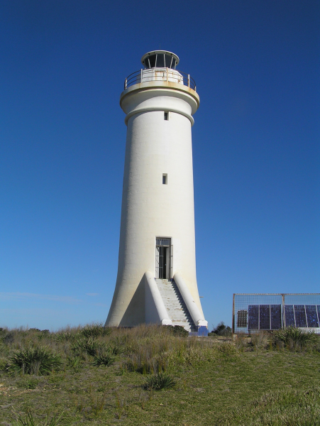
The Point Stephens Lighthouse is located either on Fingal Point or Fingal Island, depending on whether it's a low or high tide.
- Location – latitude: 32°44.9' S, longitude: 152°`11.2' E
- Height – 21 metres
- Light range – 17 nautical miles
- Year built – 1862

Norah Head
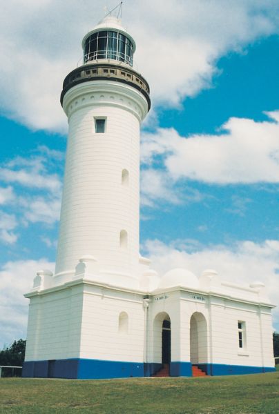
The Norah Head Lighthouse has an unusual lens that rotates in an enclosed mercury bath.
- Location – latitude: 33°16.9' S, longitude: 151°34.7' E
- Height – 27 metres
- Light range – 26 nautical miles
- Year built – 1903

Barrenjoey Head
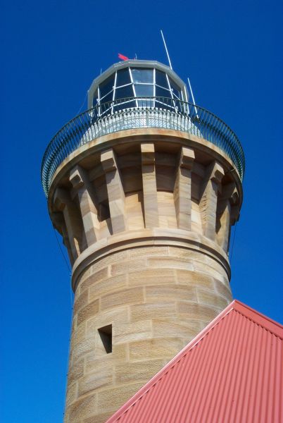
Built to help guide ships into Broken Bay, Barrenjoey Lighthouse is one of the few open to the public. The National Parks and Wildlife Service conducts tours of the lighthouse and its grounds.
- Location – latitude: 33°34.8' S, longitude: 151°19.7' E
- Height – 20 metres
- Light range – 12 nautical miles
- Year built – 1881

Kiama
The Kiama Lighthouse was established in 1887, 10 years after the creation of the Robertson Basin, a man-made harbour to service Kiama.
- Location – latitude: 34°40.4' S, longitude: 150°51.7' E
- Height – 15 metres
- Light range – 17 nautical miles
- Year built – 1867
Warden Head
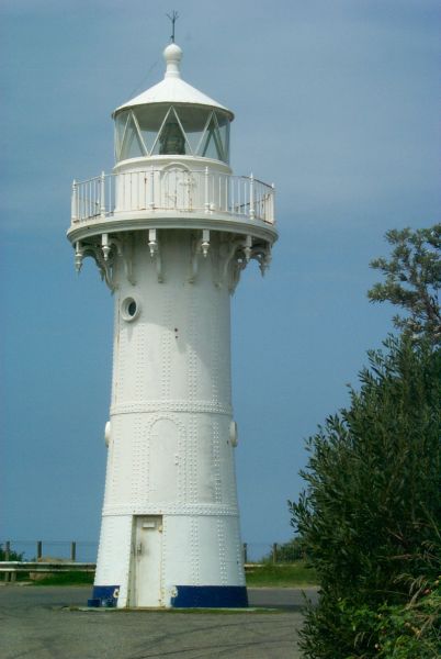
The Warden Head Lighthouse was made of curved wrought iron plates, riveted together to form a shell similar to some lighthouses in QLD, SA and WA.
- Location – latitude: 35°22' S, longitude: 150°29.5' E
- Height – 12 metres
- Light range – 14 nautical miles
- Year built – 1869

Brush Island
Brush Island Lighthouse is situated on the Tasman Sea, part of the South Pacific Ocean in the south-east of NSW.
- Location – latitude: 35°31.9' S, longitude: 150°25.0' E
- Height – 2 metres
- Light range – 8 nautical miles
- Year built – 1967
Burrewarra Point
The Burrawarra Point Lighthouse was first exhibited in 1974. It was powered from batteries and charged from the mains.
- Location – latitude: 35°50' S, longitude: 150°14' E
- Height – 10 metres
- Light range – 9 nautical miles
- Year built – 1974