Sydney Harbour Australia Day 2025
Australia Day on Sydney Harbour is a glittering spectacular and the 2025 Australia Day Harbour Program will see some of the day’s most symbolic and historic events returning to the water, as well as some new and exciting activities perfect for boaties.
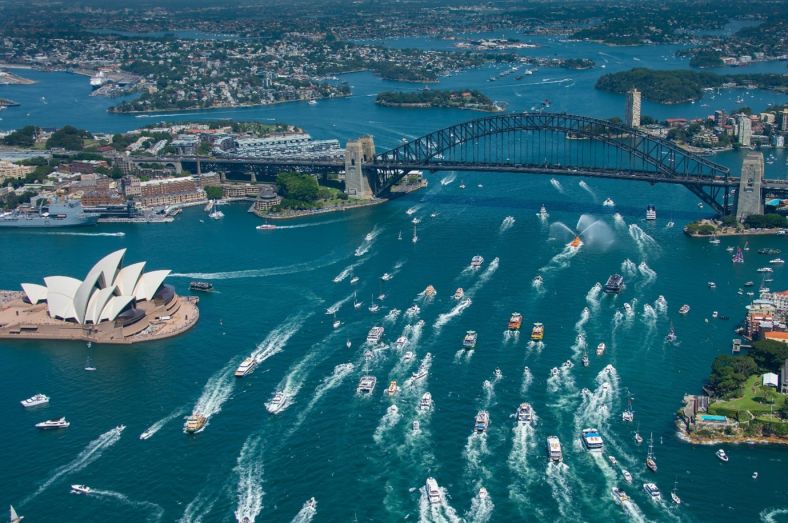
Courtesy Destination NSW
About
- Sunday, 26 January 2025
- Sydney Harbour
On Australia Day, Sydney Harbour transforms from a bustling working port to a stage full of fun and inspirational programming which can be enjoyed from numerous vantage points around the foreshore and on water.
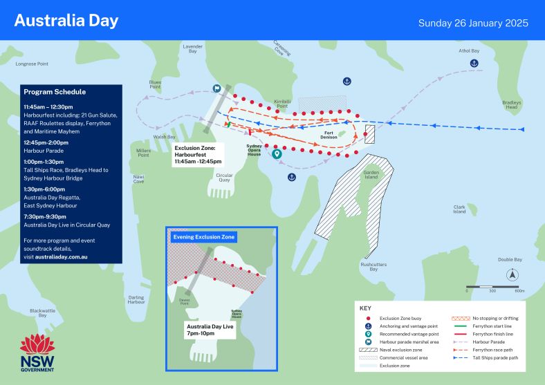
Many iconic favourite displays will return in 2025 including Harbourfest featuring the RAAF roulette display & Ferrython.
You can join the festivities by taking part in the Harbour parade. Dress the decks and be part of the annual flotilla from 12:45pm until 2:00pm, you can register at australiaday.com.au/harbourparade.
Recommended vantage points
- North-east of the Sydney Harbour Bridge - Kurraba Point, Cremorne Point, Neutral Bay, Mosman Bay, Athol Bay.
- South-east of the Sydney Harbour Bridge - Farm Cove
Commercial vessel information
| Wharf | 25/01/2025 | 26/01/2025 |
|---|---|---|
| Campbells Cove Pontoon | 06:00-24:00 | 00:00-24:00 |
| Comissioners Steps | 16:00-22:00 | 1130-1245 16:00-22:00 |
| Harbour Master Steps | 16:00-22:00 | 11:30-12:45 |
| Eastern Pontoon | 16:00-22:00 | 11:30-12:45 |
| Eastern Pontoon Nth | 16:00-22:00 | 11:30-12:45 16:00-22:00 |
| Eastern Pontoon Sth | 16:00-22:00 | 11:30-12:45 16:00-22:00 |
| Man O'War East | 16:00-22:00 | 00:00-24:00 |
| Man O'War North | 16:00-22:00 | 00:00-24:00 |
| Walsh Bay | 18:45-22:15 | |
| Ives Step | 11:30-13:00 18:45-22:15 | |
| Jeffery Street | 11:30-13:00 18:45-22:15 | |
| Beulah Street | Under maintenance | |
Tips for attending aquatic events
Sydney Harbour is an extremely busy waterway. It's used by recreational and commercial vessels, from big ships and high-speed ferries to small powerboats, yachts and kayaks.
It has busy navigational channels and special rules.
The risk of collision is much higher on the harbour, so keep a proper lookout for other vessels, swimmers, marine life, hazards and seaplanes. Be prepared to take action to avoid a collision with another vessel. You may need to slow down to travel at a safe speed and keep a safe distance.
If you're planning to go on the harbour, know your responsibilities and take extra care.
Make sure you have the right safety equipment and lifejackets for enclosed waters before you go.
Courtesy moorings and marina facilities on Sydney Harbour
Sydney Harbour has more to offer the general boating public with the installation of courtesy moorings and a destinations plan increasing access to services and amenities.
The pink courtesy moorings are available to moor recreational vessels for up to 24 hours (with the exception of Athol Bay (4 hours) and Spit Bridge (2 hours for vessels waiting for the Spit bridge opening), or where emergency mooring is required but not available. They provide an environmentally sensitive alternative to anchoring and are available for short term use by any registered vessel under the 20 tonne size limit.
Courtesy moorings have been installed around Sydney Harbour including Balmoral, Rose Bay, Chinamans Beach, Hermit Bay, Chowder Bay, Athol Bay, Taylors Bay, Camp Cove, Watsons Bay, Vaucluse Bay, Nielsen Park and McMahons Point West.
The Sydney Harbour Destinations Plan is another initiative of the NSW Government to increase the number of services and amenities available to the general boating public on Sydney Harbour through participating marinas.
Facilities available include access to toilets, pump out, water and fuel, cafés, kiosks and marine services.
When out on Sydney Harbour, look for the green Boating Destination marina banner on display at participating marinas. Blue banners within the marinas show the location of available Boating Destination berths.
To find your closest destination marina or courtesy mooring, visit the Sydney Harbour Boating Destinations webpage.
Sydney Harbour Bridge Transit Zone
The Sydney Harbour Bridge Transit Zone was created to allow safe navigation through this very busy part of the harbour. It prohibits vessels from stopping or drifting under Sydney Harbour Bridge.
The zone includes the area around Sydney Harbour Bridge, and between Bennelong Point and Kirribilli Point to Millers Point and Blues Point. It does not include Walsh Bay, Sydney Cove, or Lavender Bay north of Blues Point, or the southern end of Milsons Point ferry wharf.
You can only travel through the zone to get to an area alongside or outside the zone.
Vessels must not travel faster than 15 knots or anchor or drift in the zone, except in an emergency.

Restircted zones
Check if and where you can take your vessel on the harbour:
- personal watercraft (PWC) – you must not drive a PWC anywhere on Sydney Harbour. This includes its tidal bays, rivers and tributaries, Parramatta River, Middle Harbour and Lane Cove River.
- kiteboards – you must not use a kiteboard on the harbour
- sailboards – many areas within the harbour are restricted. Check maps and signage.
See Exclusion and restriction zones.
For information on seaplanes in Rose Bay see the best practice guide for the use of Rose Bay (PDF 373.38KB).
Ferries
You must follow the give way rules on Sydney Harbour.
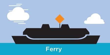
There are special rules for ferries that display an orange diamond shape. This shape is called the 'priority over sail signal'. This replaces the usual 'power gives way to sail' rule during the day, meaning that sailing vessels must keep well clear of these ferries. The 'priority over sail signal' does not apply at night or if the ferry is overtaking a sailing vessel.
Sailing vessels must keep a minimum distance from these ferries of:
- 200m from the bow
- 30m from the sides or stern.
High-speed ferries display an all round yellow flashing light when travelling at speed. Be aware that they may be travelling much faster than they appear to be.
Shipping channels
Sailing vessels and powered vessels must keep well clear of big ships in Sydney Harbour's shipping channels. These vessels are limited in their ability to manoeuvre. You must keep to starboard (right) side and give way.
Sydney Vessel Traffic Services (VTS) broadcasts safety messages and shipping movements every 2 hours on VHF 16/13. The broadcasts start daily at around 1am.
Lifejacket rules apply on NSW waterways and you must wear a lifejacket in a range of situations. Children aged under 12 must wear lifejackets at all times on boats less than 4.8 metres, or when they are in open areas of vessels less than 8 metres that are underway.
Lifejackets must be worn by everyone on small boats less than 4.8 metres when boating at night, or on open (ocean) waters, or when boating alone, or when instructed to by the skipper.
It can be difficult dropping anchor in a crowd of spectator vessels. Gain experience and confidence by practising anchoring before the big events, and follow these simple guidelines:
- Know the depth of water before you anchor, you will need anchor rope and chain at least three times the depth of water
- Ensure there is adequate chain on the anchor, generally one to two times the length of the boat
- Ensure you have an appropriate anchor for the size of the craft. Carry a spare anchor and rope/chain in case your main anchor gets fouled
- Keep your distance and maintain a space at least three times the length of your boat from other vessels anchored nearby
- Keep 200 metres clear of submarine cables or pipelines. Check the boating maps for these location or look for signs on the foreshore.
- Carry fenders as spectator areas may be very crowded
- Watch the weather. Wind and waves can cause your anchor to drag
- Do not anchor close to ferry channels or exclusion zone boundaries.
As the skipper, you must keep a proper lookout – by sight and hearing – at all times. This helps you judge your situation and the risk of collision. This is essential to keeping everyone safe on the water.
When keeping a proper lookout, look all around, including behind you. Look out for hazards so you can avoid colliding with people, other vessels, structures, land and animals. Look out for vulnerable groups, including swimmers and divers, and smaller vessels, such as sailboards and kayaks, which can be difficult to see.
Be mindful of noise – such as loud music – that could prevent you from hearing sounds or signals from other vessels or people.
Take extra care at times of restricted visibility, for example, at night (between sunset and sunrise) or in poor weather conditions.
Make sure you're travelling at a safe speed. If you have a radar, use it to keep a lookout. Remember to dim the display at night so you do not lose your night vision.
It's recommended that you have a lookout person. They can alert you if your view is blocked.
Ensure you have appropriate navigation lights, particularly if you want to attend night time events.
- Check they are in working order and you have spare fuses, globes and torches before heading out
- Ensure navigation lights are on and working between sunset and sunrise
- Turn off cabin lights as they may reduce your ability to see
- If the vessel has a flybridge and weather permits, it is generally preferable to drive from there as you will have a better all round view
- Avoid using flood/spotlights high up. These lights reduce the night vision of other skippers
- When at anchor at night, show an all round white light where it can best be seen.
Find out more information on what navigational lights are required to be displayed for your vessel.
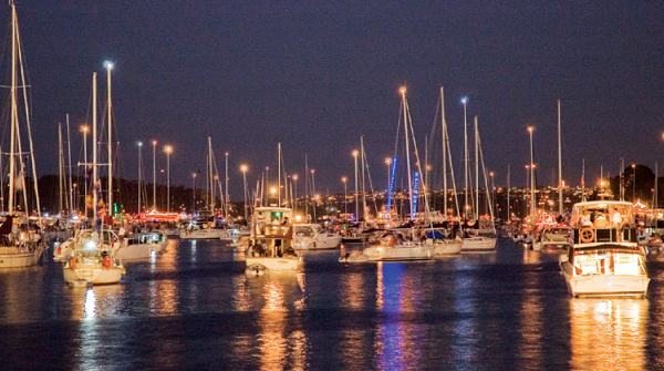
It is important to have the right communication tools so you can stay informed while afloat. In the event of illness or emergency, a marine radio will give you a direct line of communication with authorities.
In the event of an emergency on the water, communicate with authorities on radio VHF 16 or if you only have a mobile phone, call 000.
The Transport (Maritime) information line 13 12 36 operates from 8.30am to 4.30pm during all major aquatic events.
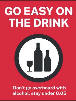
Random breath testing can be applied to skippers of boats underway. Keep below the 0.05 limit.
It can be a long day afloat and both skippers and passengers can suffer from fatigue, sunburn and wind chill. Be aware that the boating environment can multiply the effects of alcohol.
Sydney Harbour is spectacular. Let's keep it that way. It is illegal to pollute any waterways in NSW with oily bilge or galley water, litter or sewage.
Collect all your rubbish on board and dispose of it properly ashore. This includes cigarette butts and oil or grease from deck mounted barbecues. Stow it, don't throw it.
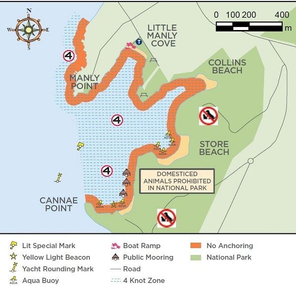
- Boaters on Sydney Harbour are reminded to keep an eye out for Little Penguins between North Head and Manly during the summer breeding season.
- A 4 knot speed limit in these 'Environmental Protected Areas' extends from Cannae Point to Smedleys Point, and includes Quarantine Bay, Store Beach, Collins Beach and Little Manly. This speed limit also continues north to 100 metres offshore from Smedleys Point toward Manly.
- Boaters must anchor at least 50 metres from the high water mark, which is identified by yellow aqua mark buoys and not in the vicinity of known seagrass beds.
